(click on map to enlarge)

Tokyo to Kumagaya
Having ridden the upper Arakawa several times as well as the lower river in Tokyo I have wanted to conquer the middle section between Tokyo and Kumagaya. So, on a warm spring day in late March, I started out from Kawasaki and rode through the heart of Tokyo, riding through Ginza on Hwy 15 and crossing over to the east bank of the Ara River just south of Asakusa.
The Ara River is a wide river that flows down from Saitama through Tokyo. Like many of the rivers in the city, it has many parks and sports fields along its banks serving as playgrounds for the citizens. There are some nice wide bike paths running all the way up past Kawaguchi. For the most part the path is uninterrupted and smooth until you get past Lake Ayako just north of Kawaguchi where there has been some flood damage and subsequent construction forcing you to ride around it.
Lake Ayako is a beautiful placid lake formed as a reservoir next to the Ara River just north of Toda. It is used as flood control and a water source for the city. You get a nice view of the park as the road curves and passes under the Sasame Bridge. Saiko Park is located on the eastern shore of the lake. It’s a spacious park with a nice path running through it.
Just after this you pass through the Omiya area with its golf courses bordering the river and soon come to where the Iruma River empties into the Ara. The two rivers run parallel for a while until the Iruma bends to the east. In this area I began to have difficulty keeping on the road designated as the official cycling route. It would run for a while then I would find a dead end and have to search to get back on the route. So, at Shiroyama Park I gave up on the cycling route and rode NE for about 4 km and turned left on Hwy 164, a road running parallel to Hwy 17 which is the main road going to Kumagaya. Though not as busy as Hwy 17, it is still plenty busy and narrow; not my favorite type of riding.
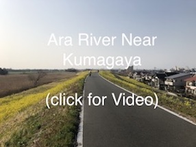
After passing through Konosu I began to approach the Kumagaya area and rode a bit closer to the Arakawa turning up onto the bike path along the river in an area called Shinkawa. It was refreshing to get back onto a quiet bike path and escape the noise of car traffic. The path runs along the top of the river bank that is lined on both sides with fields of bright yellow canola blossoms. This was the view that I have seen so many times on promotional pictures of Kumagaya. The fields ran for miles (km) along the path all the way up to Kumagaya Sakura Tsutsumi, a 2 km long line of Sukura trees that begins near Kumagaya Station. It is one of the most famous places to view cherry trees in Japan.
On this day the cherry trees were just beginning to blossom. I can imagine that it must be spectacular when they do. But the canola fields against the blue sky provided me with much satisfaction and thankfulness for being able to see them on such a beautiful day.
Beyond Kumagaya the river begins to take on a different feel as the terrain becomes more mountainous and the river looks more natural as it winds its way up through Chichibu. It would be more accurate to say it flows down from there. I write more about that in my entries for Nagatoro and for the Nichitsu Mining Town rides. Please give them a look.
Tokyo to Kumagaya Gallery